Secure Your Digital Property Rights in India.
JaaGa provides expert insights and comprehensive services for property audits, legal verification, and digital ownership. Navigate the complexities of Indian real estate with confidence.


Our Areas of Expertise
From initial checks to final documentation, we cover every aspect of property management in the digital age.
In-depth analysis and reporting on property titles and documentation.
Modern solutions for managing and securing your property documents digitally.
Comprehensive legal checks to ensure your property is free from any disputes.
Guidance and support for securing loans against your property.
Accurate digital land surveying to define and protect your boundaries.
Assistance with name changes and updates on utility documents.
Guidance and support for property tax payments and receipts.
Check for any existing loans or mortgages on a property through a CERSAI report.
Official process to update land revenue records with the new owner's name after a property transfer.
Featured Insights
Stay updated with the latest trends and advice from our experts.
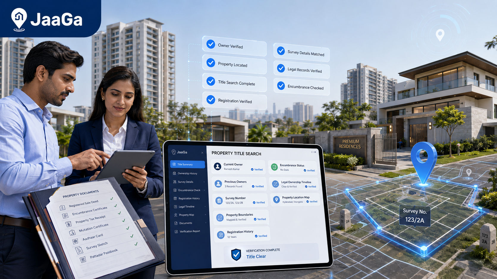
Learn how to find and locate property ownership, verify the title chain, check the right records, and spot red flags before you buy property in India.

Learn how to change the electricity bill name in Hyderabad, what documents TGSPDCL asks for, how the process works, and what to do if bills or arrears are pending.
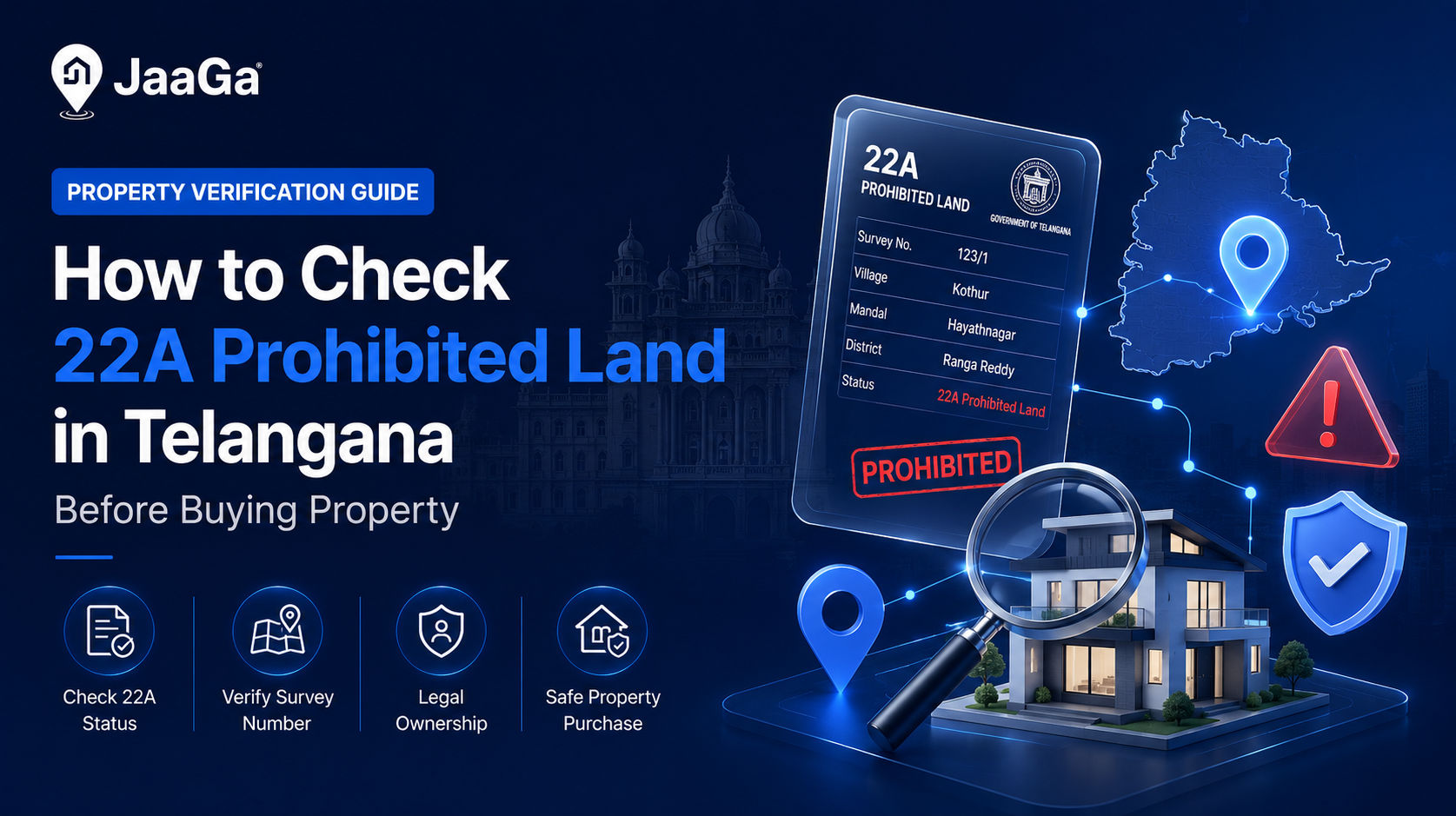
Learn how to check 22A prohibited land in Telangana, cross-check Bhu Bharati and registration records, and avoid buying property that cannot be registered.
Property & Document Help
Frequently Asked Questions
Everything you need to know about property documents, verification, and digital ownership in India.
Ready to Secure Your Property?
Don't leave your property to chance. Our digital solutions provide the clarity and security you need.
Visit Our Website